-
Help leverage geospatial analysis to solve problems, improve productivity, and increase locational awareness
-
Conduct land cover and land use change analysis
-
Remote sensing with various sensors and platforms, including Landsat, Sentinel, and LiDAR
-
Science-based datasets creation
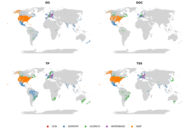
(Source: Our article on ESSD, CC-SA-4.0)

