The Arbonics Geospatial Data Platform
The Arbonics Geospatial Data Platform (AGDP) was developed to provide on-demand geospatial data analysis capabilities and an integrated processing workflow to calculate declarable areas for afforestation under given constraints, based on defined land evaluation constraints by Arbonics. The AGDP can be accessed via an integrated web application.
The project’s output was a web-accessible data service application for “suitable/not suitable” areas calculation provisioning of discretely gridded data for subsequent carbon modelling. All data were pre-processed and loaded into the AGDP database considering best practices and scientific soundness. Constraints and informative data layers were operationalized for Estonia.
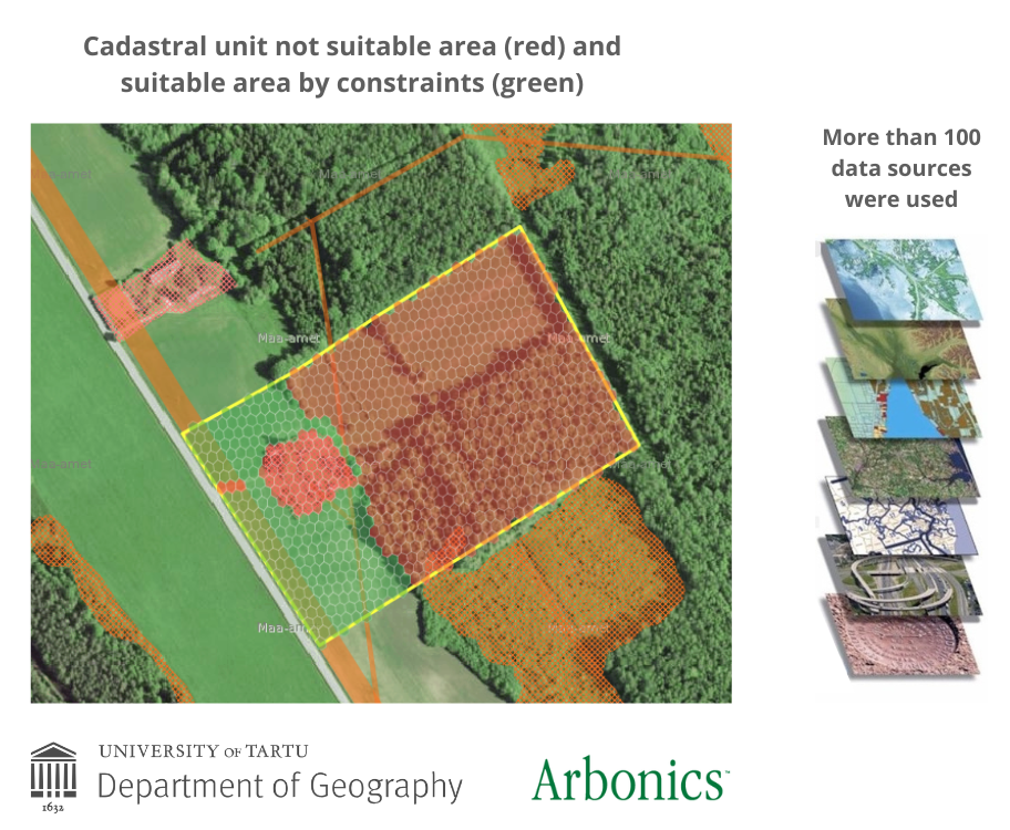
As a result of the project a fast geospatial data analysis and reporting platform was built to calculate declarable areas for #afforestation (see the example on the picture). The tool combined more than 100 spatial and other data sources with ecology and forestry expertise.
The platform comprised of opensource technologies such as Postgres/PostGIS, Geoserver and a spatial analysis engine that employs global grid technology (DGGS).